|
Soil Carbon and Other Quality
Indicators
in Managed Northern Forests |
| Sterling
Town Forest
2 sites - map below |
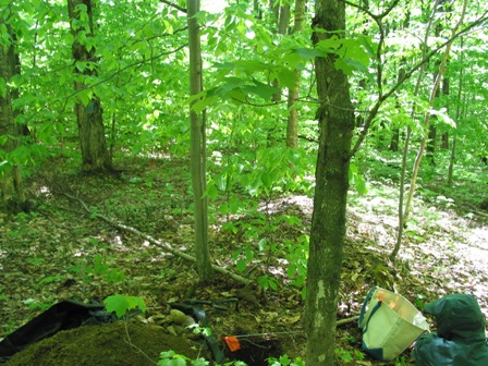
STE-
Northern Hardwood Forest
Elevation: 528
m - 1,732 ft
Average aspect: 250°
(SW)
Average slope:
6° |
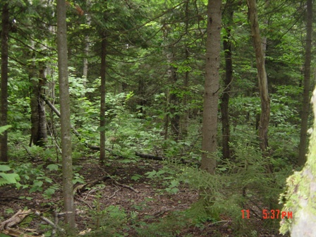
STS-
"Spruce-Fir" Forest
Elevation: 524 m - 1719 ft
Average aspect: 94°
(E)
Average slope:
6° |
 |  |
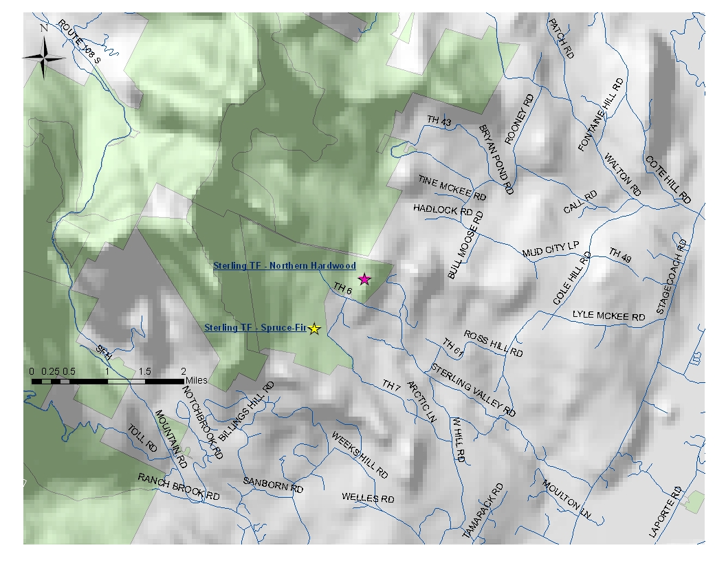
| Site History: Settlement in the town of Sterling started in 1799. Stone
walls in the area indicate a history of farming/pasture.
This site is
located in Stand 5, an area that was logged in the summer of 2008;
logging consisted of thinning/ singletree harvest to favor
regeneration. |
|
| Site History: The site is
located in Stand 3, an even-aged Northern Hardwoods – Red Spruce stand.
Management plan includes singletree and group selection harvest,
removing low quality hardwoods to favor softwoods species. |
|
STE
- Aboveground Biomass:
Average Tree Height: 13.52 m - 44.3 ft |
STS
- Aboveground
Biomass:
Average Tree Height: 10.16 m - 33.3 ft |
Percent
of total basal area occupied by each tree species: |
| Sugar Maple | Acer saccharum | 87.5% | | Yellow Birch | Betula alleghaniensis | 8.1% |
| American
Beech |
Fagus grandifolia |
4.4% |
|
| Red Maple | Acer rubrum | 44.3% | | Sugar Maple | Acer saccharum | 22.4% |
| Balsam Fir |
Abies balsamea |
14.9% |
| Paper Birch |
Betula papyrifera |
6.9% |
| White Ash | Fraxinus americana | 5.3% | | Cottonwood | Populus deltoides | 4.0% |
| Red Spruce |
Picea rubens |
1.3% |
| American
Beech | Fagus grandifolia | 0.9% |
|
Living tree and sapling biomass
(dry weight): |
| 264.6 Mg/ha
- 118 ton/acre | 182.9 Mg/ha
-
81.6 ton/acre |
Carbon stored in living trees and saplings: |
| 132.3 Mg/ha | 91.5 Mg/ha |
| STE- Forest
Floor
and Soil: | STS- Forest
Floor
and Soil: |
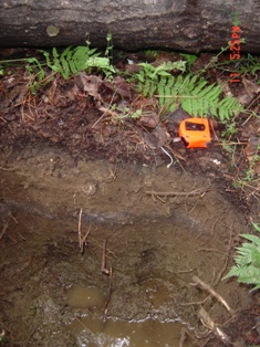
|
Soil
Pit 1
Soil Series:
Colonel
| 
| Soil
Pit 3
Soil
Series: Colonel
or Fullum |  | Soil
Pit 5
Soil Series:
Fullum
or Peru
|  |
| |
Soil
Pit 1
Soil
Series: Buckland or Fullum
| 
| Soil
Pit 3
Soil
Series: Buckland or Fullum |  | Soil
Pit 5
Soil
Series: Buckland or Fullum |  |
|